- We identify the condition of an existing investment, whether it is a field or forest, both online and on mobile devices
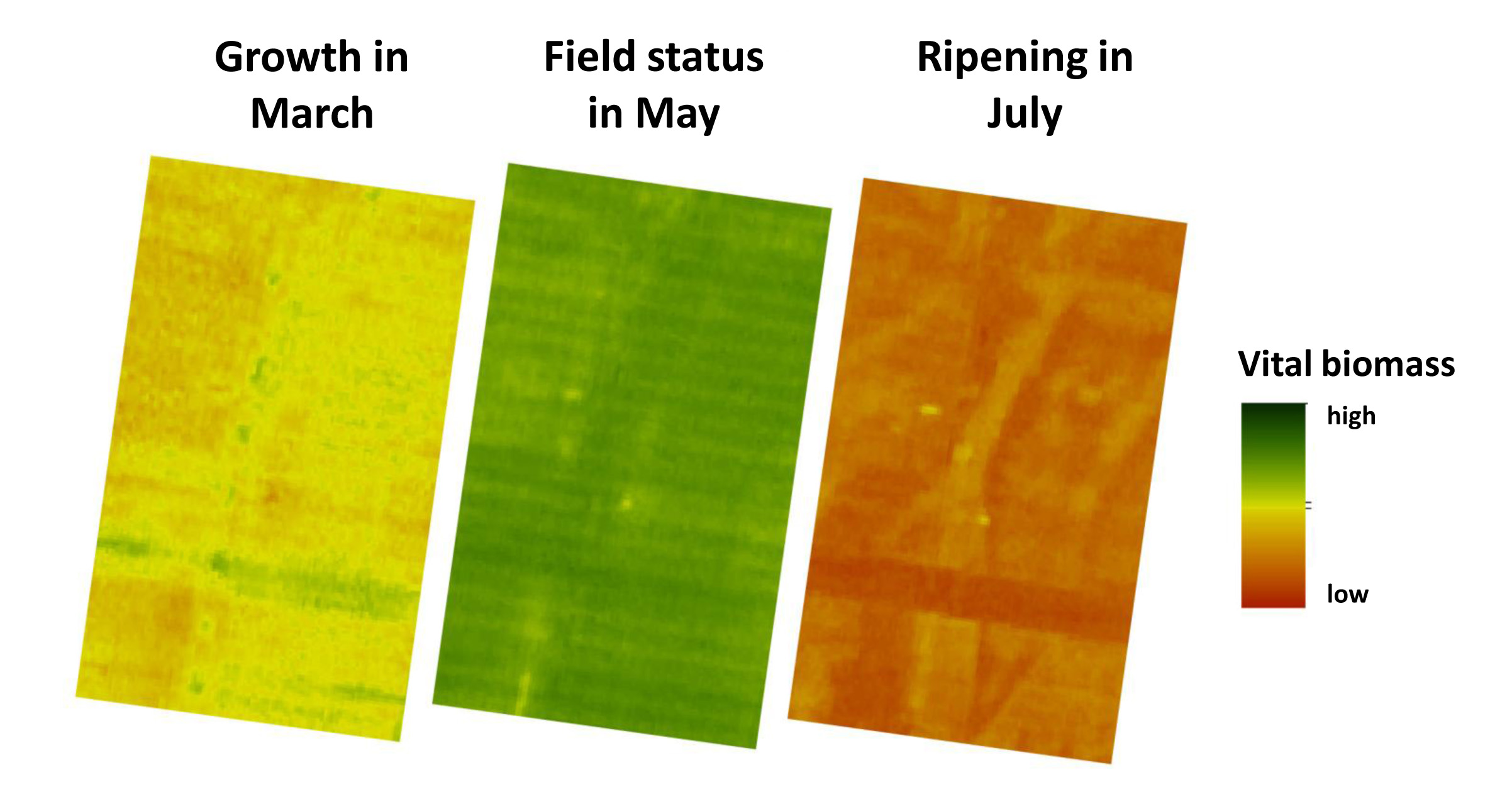
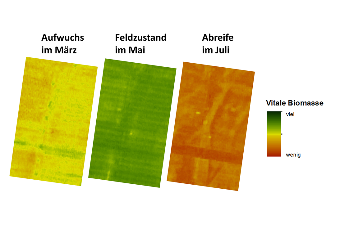
- We provide object-specific monitoring of the development of the investment value and identify even small-scale growth differentials via satellite
- We generate precise before and after comparisons after natural disasters, such as hail or rain storms, droughts or floods
- This minimizes the cost of indemnity insurance and increases your claim for compensation after natural events

Would you like to know the state of your investment property; whether the investment strategy works, and whether requirements are met? We have the satellite images and algorithms to answer these questions. Assume the role of manager and auditor from afar, without having to be on site.
Satellite images provide the answers to questions like:
- Are the areas cultivated?
- What is the predicted yield per area and subarea in relation to the total harvest? (prognosis)
- What is the status of plant development on the area or subarea?
- Are the the plants sufficiently fertilized?
- Are the plants healthy?
- Which subareas were affected by storm or hail damage and to which degree?
Satellites watch over the land, create transparency, and through continuous monitoring of the area, enhance your confidence in your investment.