- We analyze forest or agricultural investments with respect to the current yield potential using objective satellite data
- We generate future yield probabilities with consideration to climate prognoses
- We present you with the opportunities and risks of an investment
- We provide facts and figures for the investment decision
We have access to satellite and other data from agricultural and forest cultivation areas worldwide and know how to analyze, combine, and interpret this data. In this way, we create the transparency essential to your investment decision.
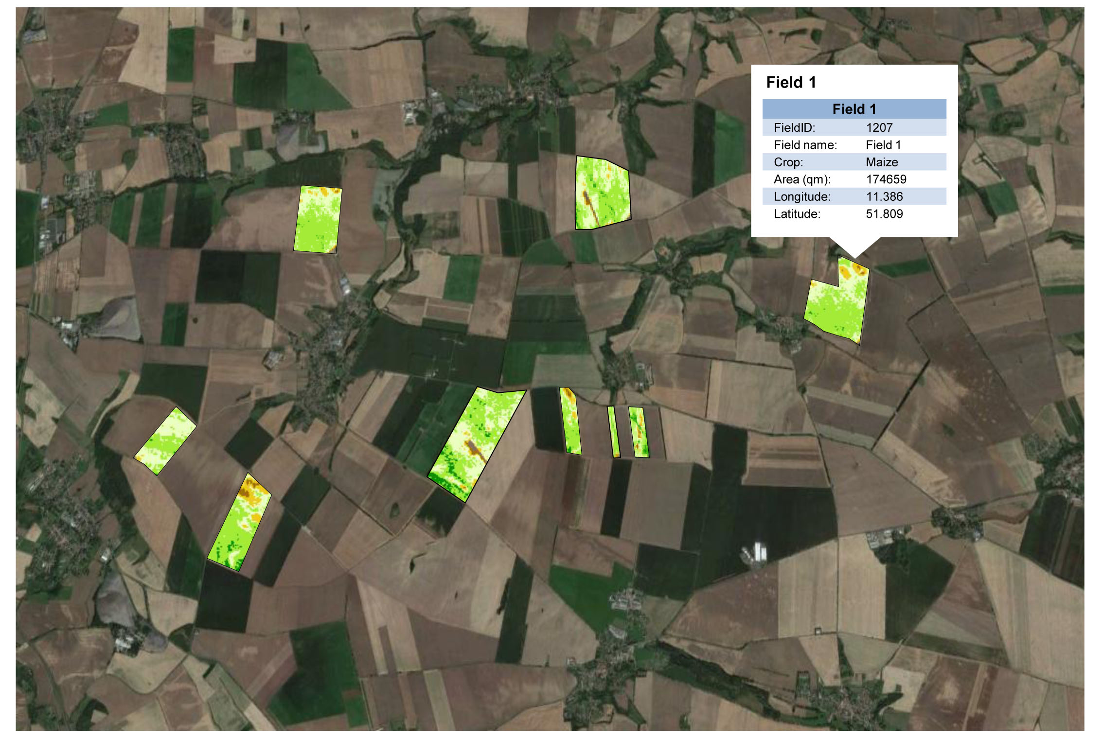 Top- and Flop- Field identification, evaluated based on satellite data and displayed on Google Earth
Satellite image maps for the field assessment
You tell us the location of your land investment. We offer a proposal for location evaluation.
During the analysis, we consider land properties such as:
- If the land exists, and its current condition.
- The size specifications of the area
- The status of the area
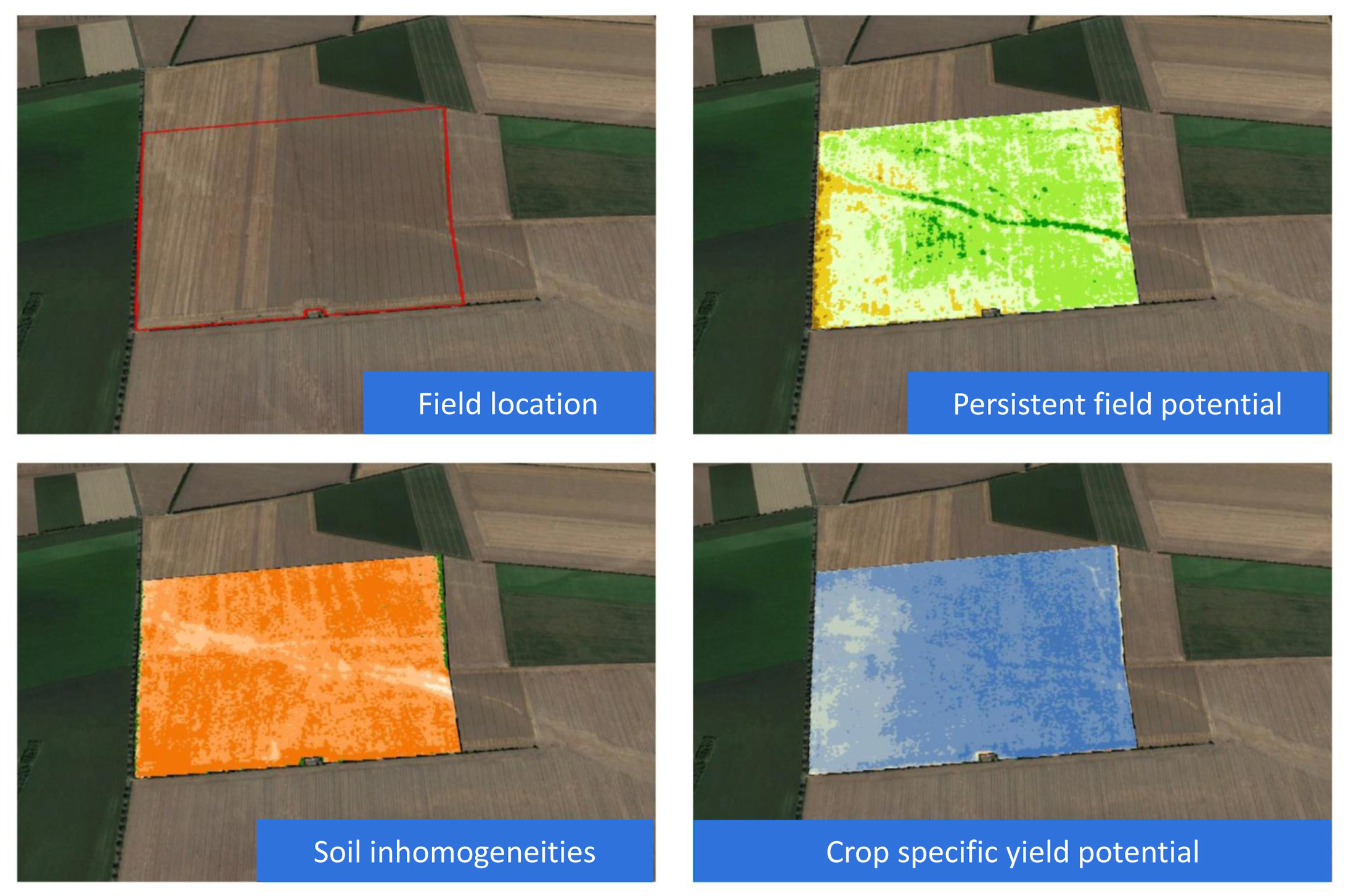
- Notable soil inhomogeneities
- The topography of the fields
- The persisting field characteristics of the field and subfield
- The individual yield potential for specific crops
- The future yield probability with consideration to climate prognoses
- Alternative possible usages
- And more
We put these land characteristics in regional context and examine, for example:
- The location of land within high risk areas (El Niño, inundation)
- The occurrence of yield-reducing weather extremes in the last decade
- The risk of common plant diseases
- And more
We provide the facts and figures for the investment decision. This gives you a neutral assessment of your potential investment.